I. Introduction
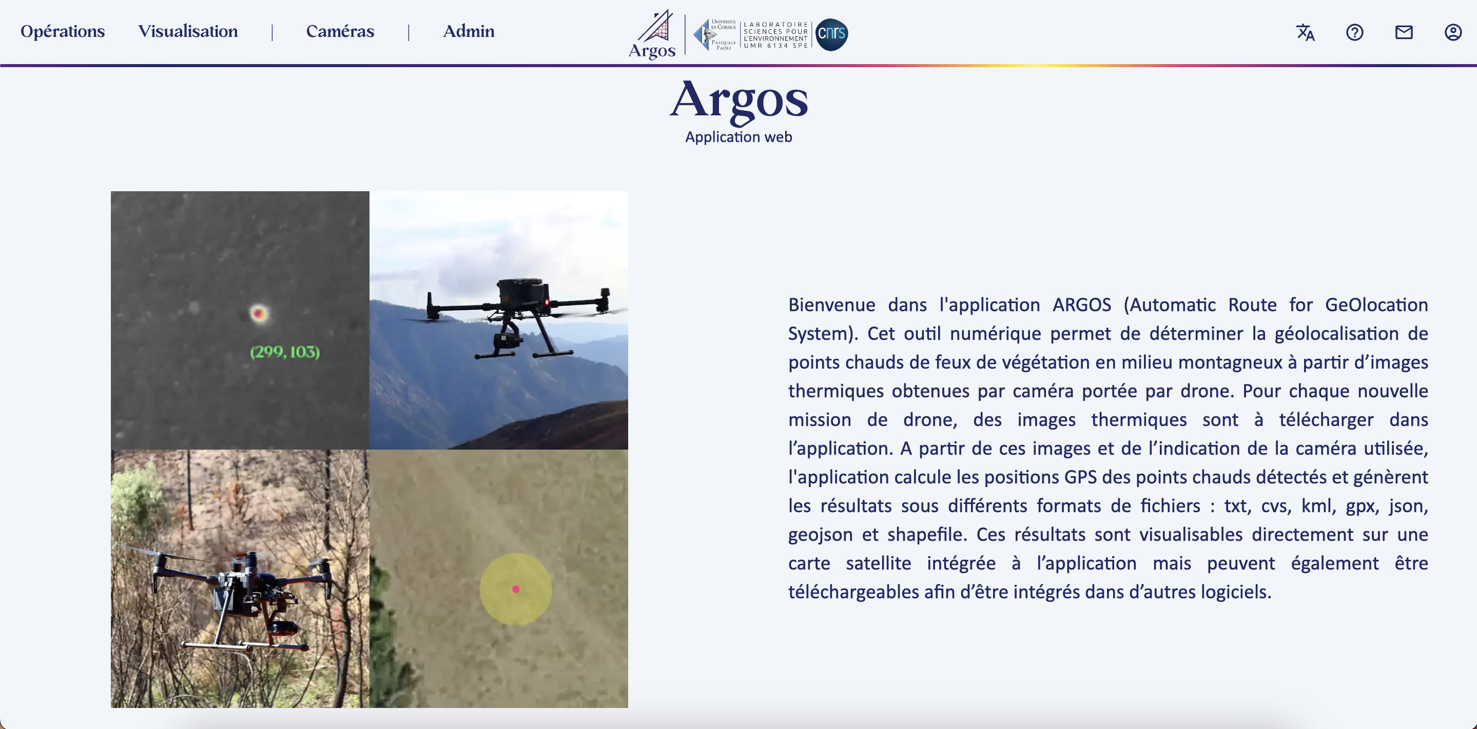
ARGOS, or Automatic Route for GeOlocation System, is a groundbreaking digital tool designed to determine the geolocation of hotspots in vegetation fires in mountainous areas. It uses thermal images captured by a drone-mounted camera to perform this essential task. The ARGOS project is part of a broader initiative called GOLIAT, affiliated with UMR SPE 6134 at the University of Corsica. The main objective of this project is to provide a tool to aid in the fight against forest fires, an increasingly challenging mission due to the intensification of fires caused by climate change. It should be noted that the ARGOS project is currently under patent and enjoys intellectual property protection.
II. Features
ARGOS offers the following features:
- Downloading drone thermal images for each new mission.
- Calculation of GPS positions of detected hotspots.
- Generation of results in different file formats: txt, csv, kml, gpx, json, geojson, and shapefile.
- Visualization of results on a satellite map integrated into the application.
- Downloading results for integration into other software.
III. Technologies Used
The development of ARGOS involved the use of several technologies and skills, including:
- Use of Next.js (React) to create the web interface.
- Advanced management of features, asynchronous requests, state management, components, TypeScript, Tailwind CSS, interactive maps with Pigeon Maps, tables, reactivity, API calls, route security, JWT token management.
- Design of user experience (UX) and user interface (UI) while adhering to a graphic charter.
- Creation of sorting algorithms for tables and search.
- Development with Docker (Docker Compose).
- User management of the existing REST API with FastAPI, including the management of the PostgreSQL database, JWT token encryption, adding routes, schemas, and updating the MCD database model.
- Improvement of the existing API with the ability to export data in different formats and the creation of zip archives.
IV. Automation and Deployment
To facilitate the deployment of ARGOS, a bash automation script was developed. It manages the launch of the application, log management, networking, and the creation of a router with a public IP address.
V. Professional Experience
I started working on the ARGOS project during a two-month internship, where I had the opportunity to contribute significantly to the development of the tool. After my internship, I continued working on ARGOS as a full-stack web development professional, thanks to a two-month fixed-term contract. This experience allowed me to gain in-depth expertise in the development and improvement of the tool.
VI. Conclusion
ARGOS is a powerful and versatile digital tool that contributes to the fight against forest fires by enabling the geolocation of hotspots. It offers a user-friendly interface, advanced features, and integration of interactive maps, making this project an essential asset for firefighting professionals.